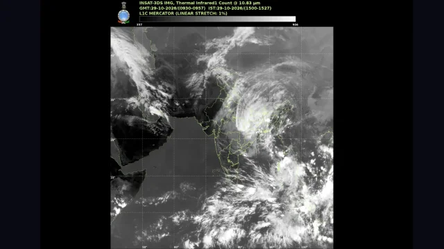
Cyclone 'Murasu' Takes Aim at Andhra Coast; How Strong Will It Get?
IMD issues Yellow Message as Cyclonic Storm 'Murasu' heads toward Andhra coast, expected to intensify into a severe storm with winds up to 120 kmph by November 3 (Tuesday).
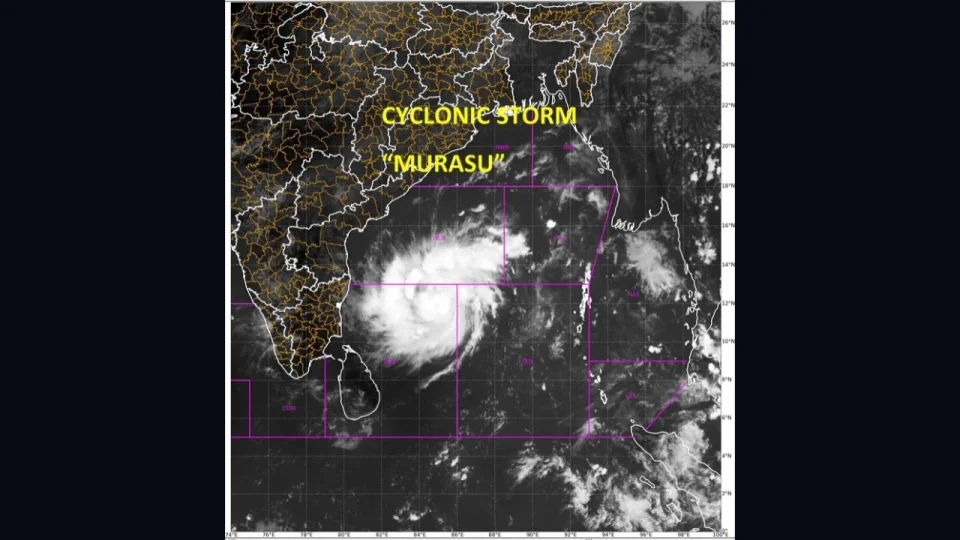
Cyclone Murasu Update: The weather system over the Bay of Bengal has rapidly escalated, with the India Meteorological Department (IMD) announcing that a depression over the south-east Bay of Bengal has moved west-northwest and intensified into a deep depression. By Sunday morning (November 1), the system further intensified into a cyclonic storm named “Murasu” over the southwest and adjoining west-central Bay of Bengal.
Current Location and Tracking
According to IMD bulletins and satellite observations, the system was centered near latitude 11.5°N and longitude 86.4°E. At its current trajectory, it is positioned roughly:
- 700 kilometres east-southeast of Chennai, Tamil Nadu.
- 770 kilometres south-southeast of Visakhapatnam, Andhra Pradesh.
- 770 kilometres southeast of Machilipatnam and 810 kilometres east-southeast of Ongole.
Deep Depression intensified into Cyclonic Storm “Murasu” over Southwest and adjoining Westcentral Bay of Bengal at 1130 Hrs IST of today, the 01 Nov 2026 https://t.co/MES1ojRza5
— India Meteorological Department (@Indiametdept)
Atmospheric conditions, including supportive sea surface temperatures around 29°C in the Andaman Sea and Bay of Bengal, favorable low-level vorticity, and low vertical wind shear, are actively aiding the system's organization and strengthening, as per the IMD in its Special Tropical Weather Outlook bulletin issued by the Regional Specialised Meteorological Centre (RSMC) New Delhi.
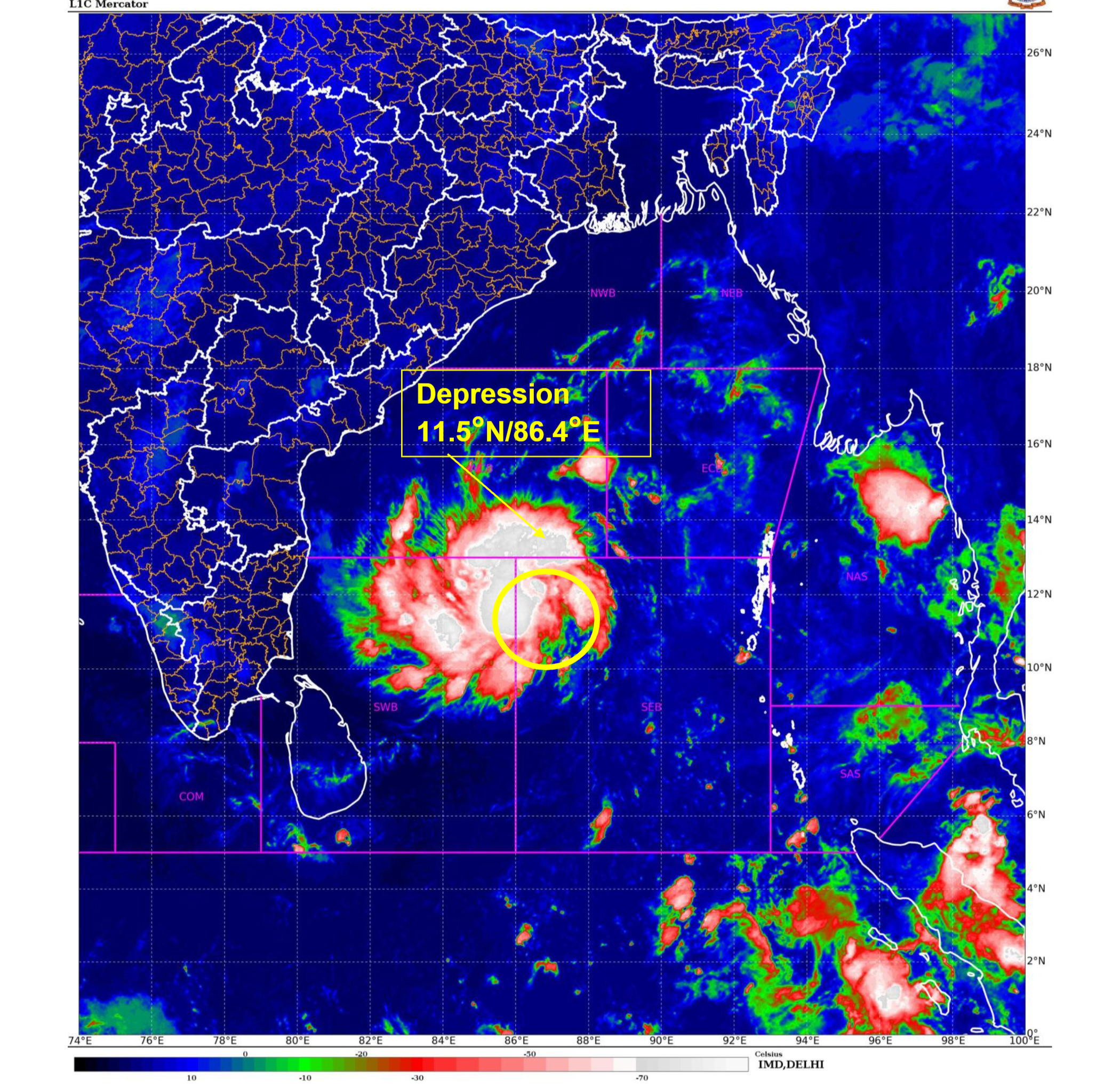
Courtesy: IMD's Special Tropical Weather Outlook bulletin
Forecast and Landfall Warning
The IMD forecasts that Cyclonic Storm "Murasu" will continue its west-northwestward journey and escalate into a Severe Cyclonic Storm by tomorrow, November 2.
- Landfall Window: The system is projected to cross the south Andhra Pradesh coast between Nellore and Narsapur around Tuesday morning, November 03, 2026.
- Wind Speeds: Upon landfall, it is expected to bring destructive maximum sustained surface wind speeds of 100 to 110 kilometres per hour, with aggressive gusts reaching up to 120 kilometres per hour.
A pre-cyclone watch with a ‘Yellow Message’ has been issued for the Andhra Pradesh coast, putting local administrations and disaster response forces on high alert as heavy rainfall and rough sea conditions are anticipated along the southeastern coastline.
The Depression over Southeast Bay of Bengal moved west-northwestwards with speed of 22 kmph during past 6 hours and lay centered at 2330 hours IST of yesterday, the 31st October, 2026 over the same region, near Latitude 10.9°N and Longitude 87.5°E, about 830 km east-southeast of Chennai (Chennai), 880 km south-southeast of Vishakhapatnam (Andhra Pradesh) and 900 km southeast of Machilipatnam (Andhra Pradesh) and 950 km east-southeast of Ongole (Andhra Pradesh). It is very likely to move west-northwestwards and intensify into a deep depression over Southwest & adjoining Southeast Bay of Bengal by noon of today, into a Cyclonic Storm over Southwest & adjoining Westcentral Bay of Bengal by midnight of 1st November and into a Severe Cyclonic Storm over Westcentral Bay of Bengal on 2nd November. It is very likely to reach over westcentral Bay of Bengal near south Andhra Pradesh coast by early hours of 3rd November and cross south Andhra Pradesh coast as a Severe Cyclonic Storm with wind speed of 100 to 110 kmph gusting 120kmph between Nellore and Narsapur by morning of 3rd November 2026.
— India Meteorological Department (@Indiametdept) October 31, 2026
Advisories
-
Fishermen and Maritime Warnings: Strict advisories and warnings have been issued for the maritime community, urging total restrictions for fishermen against venturing into the west-central, south-east, and central Bay of Bengal, and instructing all vessels at sea to return to the coast immediately.
-
Rainfall Forecast: Very heavy to extremely heavy rainfall across parts of Andhra Pradesh and Rayalaseema on November 2 and 3, with heavy spells expected to extend into south Odisha on November 3 and 4.
Naming of the ‘Murasu’ and other Cyclones
The cyclone has been officially named "Murasu," a name proposed by India, meaning "drum" in Tamil. The India Meteorological Department (IMD), acting through its RSMC in New Delhi, systematically names cyclones in the North Indian Ocean using a pre-approved roster maintained by the WMO/ESCAP Panel on Tropical Cyclones (PTC). The panel comprises 13 member countries that contribute lists of politically, religiously, and culturally neutral names. The name "Murasu" was contributed following this regional framework.